The Lowry Neighborhood

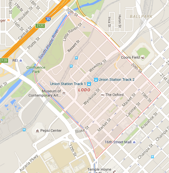
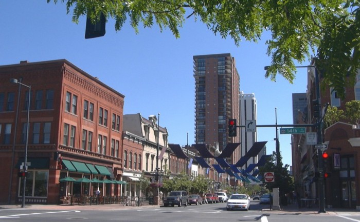
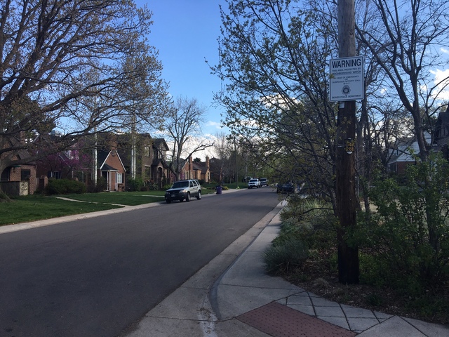
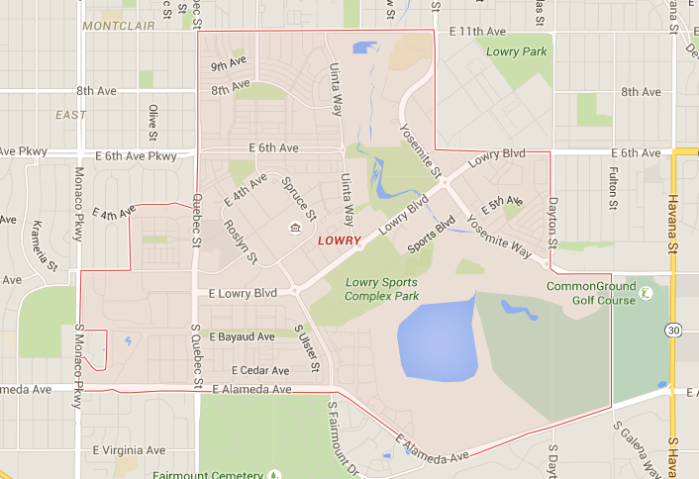
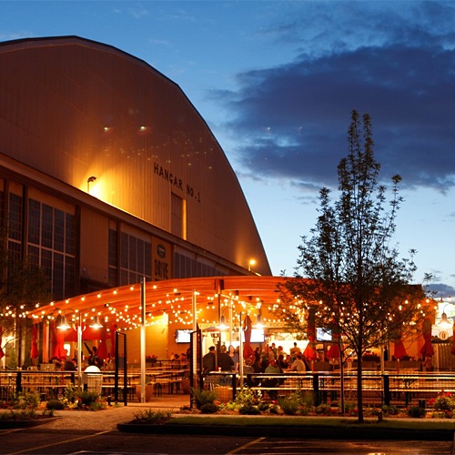
A planned mixed-usage area with distinct boundaries, the Lowry neighborhood has garnered awards and plenty of attention since it broke ground in 1996. With retail, education and recreation opportunities, corporate and residential real estate, plus parks and open space all within its three square miles, Lowry is a complete community. The centralized East Denver-West Aurora location is an easy commute to all points in the metro area. Its borders are defined by the previous, gated venue: Lowry Air Force Base. Hangers No. 1 and 2 remain as part of Wings Over the Rockies Aviation & Science Museum, where military planes are displayed indoors and out. Officers’ quarters were transformed into distinctive duplexes; other government housing and buildings were turning into lofts, apartments, and business offices.

New construction includes an impressive parkway of million-dollar mansions on Sixth Avenue. Lowry’s final completion date in 2011 includes a total of 4,600 homes and apartments with around 10,000 residents. A mix of private, charter schools, and those under the jurisdiction of Denver Public Schools cover pre-kindergarten ages to post high school with a small community college campus. Almost 30 percent of the neighborhood is dedicated to parks, trails, wetlands and open space.

lowry map
Map of Lowry
LowryBeerGarden.0
Lowry Beer Garden

Parks

Kittredge Park

Great Lawn Park


Area Information

To Downtown………… 25 min

To Cherry Creek Mall… 17 min

To I-25………….………… 18 min

Grocery Store………. Safeway


Walk Score: 66   Bike Score: 73


The LoDo Neighborhood

The Lower Downtown area was the site of the original settlement that began when people came to the region in the 19th century in search of gold. The LoDo neighborhood is one of the best examples of urban redevelopment in Denver. The lower downtown area today is one of the busiest and most exciting neighborhoods in the region. Downtown Denver is full of shops, art galleries, and restaurants, but it also has a selection of residential properties, predominantly stylish lofts and luxurious apartments.

LoDo is a hub of cultural events and entertainment in the city. Attractions within the LoDo area include Denver’s Museum of Contemporary Art, the Children’s Museum of Denver, 16th Street Mall and Elich Gardens. It is also the location of two of the major sporting venues in the city: Coors Fields and the Pepsi Center arena.

The 16th street mall promenade runs for the length of 16 blocks, with shops, boutiques, restaurants, and outdoor cafes along either side. The huge Tabor Center mall lies along this street, as does the Denver Pavilions, which the perfect place to see a movie on an evening out.

Untitled lodo map
Map of LoDo
lodotour25
LoDo

Parks

Commons Park

River Front Park

Confluence Park


Area Information

To Downtown………… 5 min

To 16th Street Mall… 5 min

To I-25………….………… 10 min

Grocery Store………. Natural Grocers


Walk Score: 94   Bike Score: 86

The Jefferson Park Neighborhood

Jefferson Park was created during the early 20th century on the site of a disused landfill. It was named after Thomas Jefferson in order to compete with Washington Park, which had recently been named. Jefferson Park, and the surrounding neighborhood of the same name, overlook downtown Denver from its situation in the area known as Northwest Denver. Stationed on a bluff above the city, the park has excellent views over the city, particularly the Central Platte Valley.

Excellent transport links connect Jefferson Park to the downtown area and the rest of the city. With downtown Denver and highlands Square within easy reach, there are plenty of nearby opportunities for entertainment, dining, and shopping.

The main commercial area within the Jefferson Park neighborhood is Federal Boulevard, which offers a good selection of stores and restaurants. A diverse range of architectural styles can be found in Jefferson Park, due to the gradual way in which the neighborhood has been built up.

mariposa_06
Jefferson Park Neighborhood
jefferson park map
Map of Jefferson Park 

Parks

Jefferson Park

Hallack Park

Gates Crescent Park


Area Information

To Downtown………… 10 min

To 16th Street Mall… 10 min

To I-25………….………… 5 min

Grocery Store………. King Soopers


Walk Score: 78   Bike Score: 82

The Hilltop Neighborhood

It is hard to believe that Denver’s prestigious Hilltop neighborhood was originally developed as a country suburb of Denver. Today, this charming urban neighborhood, which is located just east of Cherry Creek, is in the center of central Denver Real Estate.

Hilltop, which was primarily developed between 1920-1940, is widely known for its distinctive Tudor architecture but also features other architectural styles including colonials and more modern styles. Hilltop’s residents take pride in larger lots that sit back further from the street than those in other Denver neighborhoods. Alleyways are noticeable absent due to the fact that Hilltop’s lots were intended for automobiles rather than streetcars. The neighborhood gets its name from the high elevation of the area, and therefore offers some wonderful views of the Front Range mountains.

Hilltop, which is bounded by Colorado Boulevard, Alameda, 6th Avenue, and Holly, is only a few minutes from downtown Denver and the Cherry Creek shopping district. Hilltop residents can easily access downtown Denver’s rich entertainment and cultural opportunities. In addition, the historical Cranmer Park, one of thee parks, provides endless recreational opportunities.

HILLTOP NEIGHBORHOOD_1461810485691_37128838_ver1.0_640_480
Hilltop Neighborhood
hilltop map
Map of Hilltop


Parks

Cranmer Park

Robinson Park


Area Information

To Downtown………… 16 min

Cherry Creek Mall…… 4 min

To I-25………….………… 15 min

Grocery Store………. Trader Joe’s


Walk Score: 54   Bike Score: 68

The Highlands Neighborhood

The Highlands is one of the most sought after addresses in Denver. With some of the city’s most beautiful historic homes, recently redeveloped commercial areas, and excellent transport links to the city’s business center in the downtown area, the Highlands has attracted a lot of attention. It is one of the most vibrant and interesting places to live in the city, with a diverse and active community.

During the early 19th century, immigrants from English, Scottish, Italian and German backgrounds flocked the area. The street names in the area and many of the historic landmarks still bear the marks of the area’s history in The Highlands contains some of the most historic and architecturally interesting buildings in Denver, which have been carefully preserved during the redevelopment of the area. The most interesting buildings in the Highlands are in the Stonemans’ Row and Potter-Highland Historic Districts. The neighborhood contains a variety of different homes, including many high end lofts and condominiums, many of which were built during the redevelopment that has taken place in the area since the 1990s. There are still many of the historic single family homes left in the area.

The Highlands neighborhood is one of the most attractive in the city due to the combination of wide, tree-lines streets, parks such as Highland Park, and historic homes. Highlands also has a wide range of shopping, dining, and entertainment venues. Highland Square is the main commercial area in the Highlands neighborhood. It contains a wide range of shops, boutiques, bars, and restaurants. Highlands Square attracts people from across the Denver region.

146bca6a85147c096aaff40552825424.jpg
Lower Highlands
Untitled
Map of Highlands


Parks

Sloan’s Lake Park

Highland Park


Area Information

To Downtown………… 17 min

To 16th Street Mall… 17 min

To I-25………….………… 8 min

Grocery Store………. Sprouts


Walk Score: 78   Bike Score: 82

The Golden Triangle Neighborhood

The Golden Triangle is still undergoing many transformations. The Denver Art Museum’s new wing was completed in fall of 2006, further developing the neighborhood’s art scene, which includes various art galleries and the Curious Theatre Company. The neighborhood is bustling with vibrant businesses.

The Golden Triangle is one of the oldest neighborhoods in Denver, with many single family Victorian homes and bungalows built in the late 19th and early 20th centuries. Between 1904 and 1919, Denver Mayor Robert Speer completed his ambitious plan for the Civic Center area, adding many civic institutions and a neoclassic park to the north of the neighborhood. He placed a leafy concrete urban canyon around Cherry Creek, creating Speer Boulevard, the neighborhood’s western and southern border. After World War II, the Golden Triangle became a business support area for the central business district. New condominium and loft developments came into the neighborhood, and many of the old supply stores and garages were transformed into restaurants, art galleries, and small offices.

20140513185459-GT-2
The Golden Triangle, Denver Art Museum
goldentrianglemap
Map of the Golden Triangle Neighborhood

Parks

Sunken Gardens Park

Civic Center Park

Area Information

To Downtown………… 8 min

To 16th Street Mall… 8 min

To I-25………….………… 10 min

Grocery Store………. Tony’s Market


Walk Score: 91   Bike Score: 96

Cherry Creek Arts Festival

The Cherry Creek Arts Festival that is a world-class and award-winning celebration that last for three days, every year in the Summer. The festival celebrates artist all from all around the State of Colorado and the United States. It includes visual arts, culinary arts, and performing arts. This event is completely free to attend to and the attendance is usually around 350,000 every year. This year the Cherry Creek Arts Festival is July 2nd through July 4th. It’s a family friendly event and is just one of the many things Colorado has to offer to it’s residents.

cherry-creek-arts-festival-image-1cherry-creek-arts-festival-image-2

The Five Points Neighborhood

The Five Points neighborhood is named because it is located at the point where the diagonal grid of downtown Denver meets East Denver’s rectangular grid, creating a five way intersection where Washington Street, 26th Avenue, 27th Street and Welton Avenue meet. The neighborhood lies within the east side of Denver. Five Points is one of the oldest neighborhoods in Denver. Much of the neighborhood’s growth occurred during the 1860s and there are many interesting, historic properties still standing within the area. The light rail and the proximity of the neighborhood to downtown Denver have attracted many new people into the neighborhood.

The history of the neighborhood and its African-American heritage can be explored in the Black American West Museum and the Heritage Center, which is located within Five Points. The Five Points neighborhood is today a far more diverse community than ever. It attracts people from all over Denver. Both the Five Points Jazz Fest and Juneteenth is still held in the neighborhood every year and are a major attraction. This festival celebrates the abolition of slavery.

0459
Five Points
Untitled five points
Map of Five Points


Parks

Lawson Park

Benedict Park

Fuller Park


Area Information

To Downtown………… 5 min

To 16th Street Mall… 5 min

To I-25………….………… 10 min

Grocery Store………. Safeway


Walk Score: 85   Bike Score: 94

The Edgewater Neighborhood

The Edgewater neighborhood, located on the western edge of Sloan’s Lake, is growing in popularity for young home buyers due to its accessibility to downtown Denver and affordable home pricing. Edgewater got its start as a cluster of fishing shacks in the early 1900s, but has since grown to a full town with its’ own style and energy.

Edgewater Park, overlooking Sloan’s Lake, is a great place for kids to play and hang out, for adults to meet and greet each other, and for dogs to run (on leash of course) near the water’s edge. The town’s mayor, city council, and business people feel that Edgewater’s time has come to create a true neighborhood character. Based on the location of the park and lake, and the well-attended Dragon Boat Festival held each summer on the lake.

3124_1441127693_edgewater.jpg
Edgewater
Untitled map
Edgewater Map

Parks

Sloan’s Lake Park

Walker Branch Park


Area Information

To Downtown………… 23 min

To Cherry Creek Mall… 35 min

To I-25………….………… 10 min

Grocery Store………. Whole Foods


Walk Score: 69   Bike Score: 75

Old Colorado City

Old Colorado City is a national historic district in the city of Colorado Springs. It’s boundaries are  U.S Highway 24 to the South, 32nd Street to the West, 13th street to the East and Uintah Street to the North. Old Colorado City was founded in 1859 when the Colorado Town Company laid claim to the two-square miles of land. They envisioned Colorado City would be a major supplier of gold because the Pike’s Peak Gold Rush had recently been made.

Now, Old Colorado City has a shopping district featuring dozens of independently owned  art galleries, boutiques, restaurants and special attractions. This artsy strip is also home of the Michael Garman Museum and Gallery.

old-colorado-city-historic

Untitled